


Aerial Photography For Properties
Aerial photography can be done using an aircraft, balloon, drone, or even a kite or skydiver. Taking the same shot of your property during each of the four seasons can make an impressive photograph collage (and makes a great, unique, albeit pricey gift). Aerial photography is not new. According to Wikipedia, it was first done by the French photographer and balloonist Nadar in 1858, and aerial photography expanded its use for military purposes during World War I.
A photo looking down on your property can help develop your land, such as planning fences, barns, or selling off lots (real estate agents use aerial drone photography a lot in advertising, especially with big expensive properties). A shot from the sky shows you the lay of your land and enhances ideas for improving your property—displaying just the right spot for that pond you’ve wished for—or, if you repeat the effort every few years or so, it can give you a historical perspective. I was renting a house on an old farm some years ago and was offered the purchase of an aerial photo of the property. It wasn’t my property, so I wasn’t interested. But the land later was sold to the government as a potential local landfill. That air-view photo, along with one of the landfill, could have made a fascinating before-and-after comparison.
With the ease of purchasing a drone, you might think this is a simple do-it-yourself task, but experts disagree. To get a good aerial shot, you need to study and practice. You also may need an FAA license and liability insurance. Be sure you check your local, state, and federal laws. And don’t forget about privacy laws and annoying your neighbors. By far, the most impressive aerial shots are of vast areas, showing hills, changes in vegetation, development, and wildlife. Think about the breathtaking photos you’ve seen of Alaska, the Rocky Mountains, or a lakeshore. Towns often use photos like these to map topography changes, plan developments, or designate protected areas. Professional photographers take them for these and other journalistic, commercial, or historical purposes. Good photos come from top-notch equipment used by professionals with an eye for a great picture, an understanding of light, and the ability to manipulate the equipment correctly. Google Earth images are aerial photography, too, but they’re rarely something you want to frame.
Posted on March 18, 2021
Lawn Care: There’s an app for that.
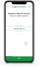
Maintaining that 5-star landscaped look is now more convenient than ever. Download our free app to book and manage landscaping services anytime, anywhere.
We'll text you a link for the free app


Order landscaping services for your home online, anytime!
Select a service to get your free quote


Get a Free Online Quote Now
Leave the yard work to the pros this year, you can browse our services and schedule an appoinment online, anytime !